Roll20 and Gods & Monsters

The polygonal reveal generally works well, as long as there are corners. As you can see, I was not patient enough to get the circular lobby completely within the lines. Note that the grayness is blackness for the players; the fog of war only shades things for the game master.
Because the Gods & Monsters maps are made with layers in Inkscape, they are easy to repurpose to other uses. For example, Rob Conley, several weeks ago, mentioned Roll20 over at Bat in the Attic. Roll20 accepts PNG and PDF images, and it honors transparency.
To create the player map, I unchecked visibility on everything except for the map itself: no grid, no key, no secret places.
Then, for the GM overlay, I unchecked everything except for the key. Because Roll20 honors transparency in PNG files, the map shows through.
The “fog of war” is especially useful: it lets you show only the specific part of the map they’re currently able to see. Fog of war is a setting in the page’s settings from the gear in the page toolbar. It’s only drawback is the lack of reveal shapes. There are only two reveal tools: rectangular and polygonal. So you can make any shape you want, as long as it has corners. This makes it a bit tricky to reveal full tower rooms or grand balconies without revealing the areas beyond the tower or balcony. You need to be careful setting up the polygon.
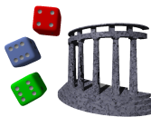
Very cool—with a caveat—is the map measurement tool. It quickly shows distances simply by drawing a line from start to finish. That’s as long as you aren’t looking at an overview of the entire map: the size of the measurement number scales down with the map, so if you set the map to be 20% size, the measurement number is also 20% size, practically unreadable.

The map measurement tool quickly calculates distances.
It has a dice language for setting up die rolls. For example, 4d6 drop the lowest is performed as either “/roll 4d6d1” (4d6, drop the lowest one) or “/roll 4d6k3” (4d6, keep the top three). I kind of like the “keep” option because it doesn’t duplicate the “d” and is thus easier to read. Common dice rolls can be set up as buttons for quick access. In the screenshot on this page, you can see three buttons in the lower left. One for surprise, one for attacking, and one for rolling all six abilities.
The system also lets you set the number of squares in the grid. Most of my maps are bigger than the default grid size. You can also set the size of the grid, in pixels or the size of each unit in pixels.
If I were running a Gods & Monsters game online, I’d seriously take a look at Roll20; it’s a snap to take layered maps and upload them so that the players see the map and you see the map and the key. Player handouts can be set up ahead of time as a “handout” and then dropped into a character’s journal, to be seen only by that character.
One useful tip, you can hit your own gear icon and “Re-Join as Player” to see what your players are seeing. It’s spooky to see the map with nothing showing but where they’ve already been!
- Roll20
- “Roll20 is the easy-to-use virtual tabletop that brings pen and paper gaming to the web the right way. Built on a powerful platform of tools, yet elegantly simple, it focuses on enhancing what makes tabletop gaming great: storytelling and camaraderie. It's incredibly user friendly, and runs right in your web browser, so there's nothing to download or configure.”
- Roll20 1 vs Fantasy Grounds 0: Rob Conley at Bat in the Attic
- “Lately I have been having nothing but trouble with Fantasy Grounds. It sensitive to network troubles and my router and DSL line have been causing problems by resetting every couple of hours. Due to the holidays I haven’t been able to get it resolved with my ISP yet, however I did activate an Roll20 account as a backup.”
More gaming tools
- First level calculations in Pocket Gods
- If you need to quickly calculate reactions and other numbers for a first level character, Pocket Gods can now do that for you.
- Automatically grab flavor text snippets in Nisus
- In Nisus, it is very easy to grab all text of a specific style, and its nearest heading. This makes it easy to make “room description cards” for handing to the players after reading them.
- hexGIMP for old-school wilderness maps
- The isoMage has a script and brushes for GIMP that make it easy to create old-school TSR-style outdoor maps.
- Constructing encounter tables using Nisus
- Here’s a Nisus Writer macro that makes it a little easier to create encounter tables.
- How to use hex maps
- Rob Conley describes the benefits and tricks of using hex maps.
- 13 more pages with the topic gaming tools, and other related pages
More maps
- hexGIMP for old-school wilderness maps
- The isoMage has a script and brushes for GIMP that make it easy to create old-school TSR-style outdoor maps.